 |
| It felt longer than 3.6km |
 |
| the Waterfall |
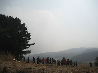
On March 9th, I hiked Jangsan (san = mountain in Korean). We reached the peak after about 2 1/2 hours. It was pretty foggy that day so we couldn't see the view of Busan. The peak was about 650m. It was a pleasant hike; not too intense and it took us about 3 1/2 hours up and down.
Here's the direction we found online... in case anyone reading is interested in hiking Jangsan.
'Take Jangsan subway exit 10. Walk straight toward Daecheon Park (and the mountain obviously). From there just follow the road up past a few scenic little temples and a waterfall. Eventually the paved road will end and you’ll be in a large circle area with many trails branching out. Go up the steps and just follow the signs toward Jangsan peak. Eventually the signs will become pretty sporadic, so just kind of follow the trail up. Go toward the top. Remember Daecheon Park and Pokposa Temple, because there are a few possible trails down the mountain and you wanna go toward these.'
 |
| Physical Park with exercise equipments |
 |
| Group activities |
 |
| It was a dangerous hike! |
 |
| Caution! |
 |
| Almost there but too foggy |
 |
| Made it, we passed it and had to walk back. |
 |
| Daecheon Park at the bottom of the mtn |
No comments:
Post a Comment